Screaming Kiwis, thieving Keas and other tales from the Kepler Track
Our Kepler adventure starts with a diverted flight from Christchurch to Queenstown. Due to high winds at Queenstown, we are informed in mid-air that our small aircraft will now need to land in Invercargill instead. Invercargill being the southernmost city in New Zealand.
Flying over Queenstown, instead of into Queenstown - there was fresh snow on the Remarkables and the mountains surrounding lake Wakatipu
Love this question!
Landing in Invercargill is exciting for me - I get to see a part of New Zealand I’ve never been. Unfortunately for us, we need to pick up our car in Queenstown and so instead of going directly to Te Anau in Fiordland, we need to take the bus back to Queenstown airport and then double-back half of the road. I’m quite impressed with Air New Zealand - within minutes they have a bus ready and are loading the passengers and the luggage on it for a 2.5 hour trip to Queenstown. Fortunately, we are not in a huge rush, so we take the time to take in whatever sights we can of Invercargill from our bus window. It’s clearly a farming / industrial community - I don’t think I’ve ever seen so many stores for tractors, bulldozers and other farming equipment.
Sight-seeing in Invercargill on the southern tip of New Zealand
By the time we hit the Kepler track, we’ve been tramping non-stop for the last week. The Kepler is another one of New Zealand’s Great Walks, just like the Routeburn and the Milford Track. And like the Milford and one side of the Routeburn, it is located in Fordland National Park, by Milford and Doubtful Sounds. By the time we book the track sites in early January, there are only a few dates left. But Brent works his relentless planning magic and we line it up perfectly between the rest of our hiking and our mountaineering school in mid-February. The huts are all booked up, but we prefer to camp anyway, so we book the two campsites closer to each end of the track - the campsite on Brod Bay (on Lake Te Anau) and the campsite in Iris Burn, on the Lake Manapouri side. The length of the track is about 60 km (37 miles), although we will skip the final section, which leaves us with about 52 kilometers (32 miles). We’ll cover half of that distance and most of the elevation gain (over 6,000 feet) in the middle day, which is turning out to be a pretty long day with heavy packs.
The place in Te Anau where we grab early dinner before heading out on the Kepler track. We took a "smile" for the road :)
We stop to check the weather forecast at Chris' forecasting service at the parking lot - apparently, we're on for nice weather :)
The first day we only walk a couple of hours to our campsite on Lake Te Anau. The camp location is an idyllic looking setting right on the lake. The only problem is that the water tank is empty but we are advised that the water in the lake is safe to drink. After all, it comes from the snowmelt in the Fiordland National Park. We fill our cooking pot and our water containers straight from the lake. It’s a tricky exercise - the bottom is sandy and the lake is shallow and calm.
Starting on the Kepler track in the evening with an easy trail to the first camp site
Lake Te Anau from the Broad Bay campground
Lake Te Anau in the morning
Just as we’re ready to hit the road around 8am, we hear a boat sound. It’s a water taxi that dumps about 12 people on the shore - day hikers, who will walk to Luxmore Hut and then back to the boat in the same day. Luxmore Hut is about a third of the way to our second campsite. We silently berate ourselves for not getting organized sooner. If we had known that there was going to be a group of hikers dumped on our shores, we would have made sure to leave at least an hour earlier. Most of the hikers are young Europeans. But there’s the silent solitary Asian guy who for a little bit is sprinting to keep up with us on the trail after we pass him. And there’s also an older but extremely fit American couple - they look to be in their 60’s and they are carrying tiny little hydration packs. Their plan is to run up the hill to the emergency shelter (a few miles past Luxmore Hut) and then run back down. I like them the best - unlike the younger Europeans, who in this group are so chatty that it spoils the silence of the place, these Americans are friendly, quiet and smile at everyone. I look at the woman and think - “damn, that’s how fit I want to be in her age”. That, and a bit of yoga, of course :)
The track up the hill towards Luxmore Hut
The weather gods have been kind to us - we have caught the only day and a half of fine weather between two storms, so as we climb the track, we are rewarded with sweeping vistas of peaks and lakes as long as the eye can see. On the way to Luxmore Hut, we briefly stop at the Luxmore Caves but don’t go too far into the cave once we see in the light of our headlamps that there is no path or railing - just a wet slippery slope. I slip but manage to regain my balance. We shine our light on the stalactites and other formations on the ceiling and turn back, resuming our walk.
Luxmore Caves - just a tad slippery and not too many glow worms
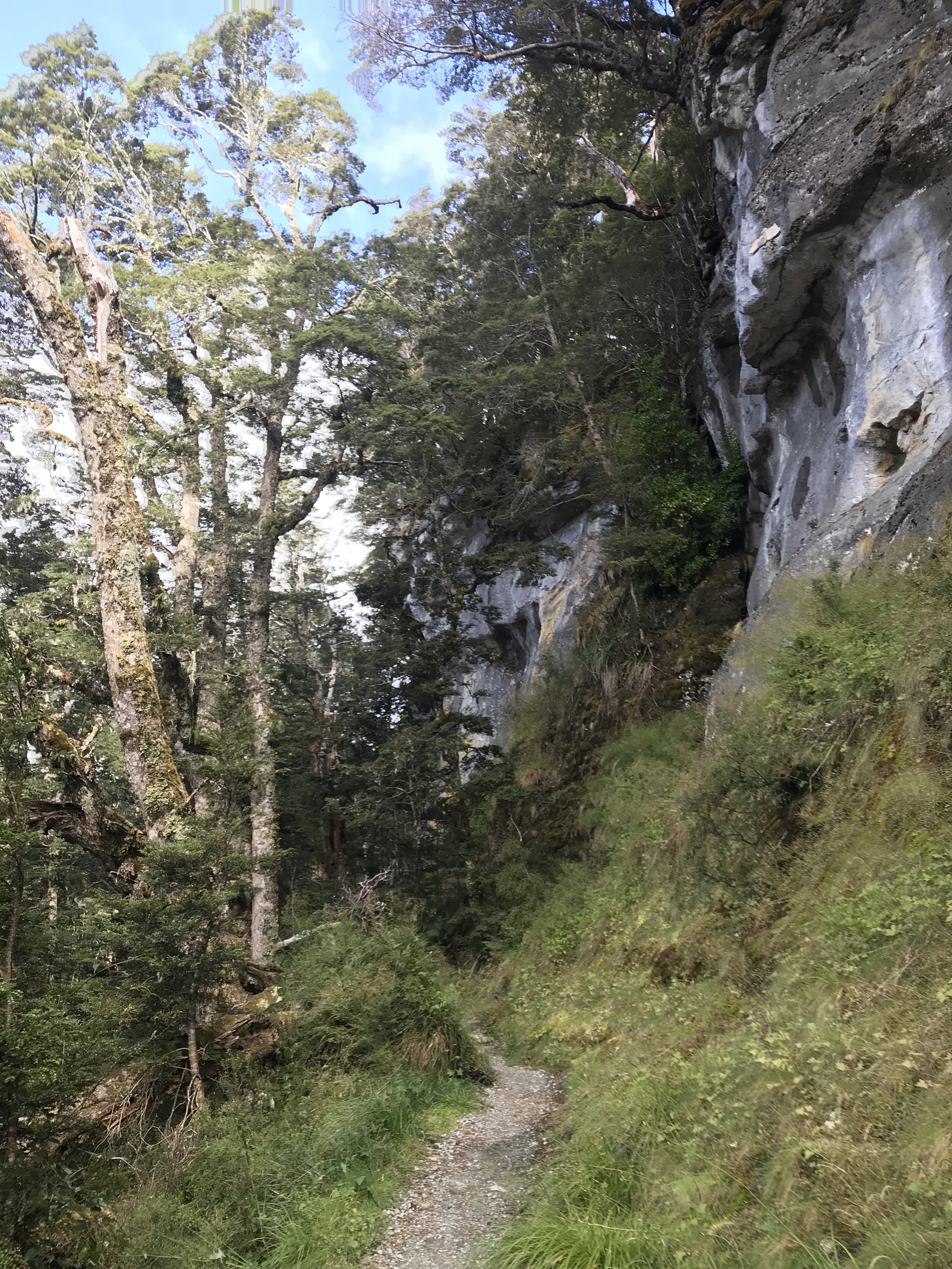
After our bush-whacking days on the Banks Peninsula and Arthur’s Pass, we decide that the Great Walks are not really “trails” but more like roads. There are steps, bridges, and clear paths put on terrain that we would slog through in other places. We come across a few rangers who are repairing some recent rain damage - they are digging up stones and placing them on the path to make it even. As we pass them and thank them for making the trail nice, they reply: “yep, until the next rain storm”. The friendly ranger (former farmer) at Iris Burn will tell us that DOC rangers typically walk between 20-30 kilometers per day, monitoring and repairing the trails. That’s the extend of funding and maintenance that New Zealanders have to do on a walk that’s designated as a Great Walk, especially if it goes through rough patches that can get washed out by rain. Resilience and “getting the job done” under all conditions seem to be quintessential Kiwi traits, dating back from the hearty settlers.
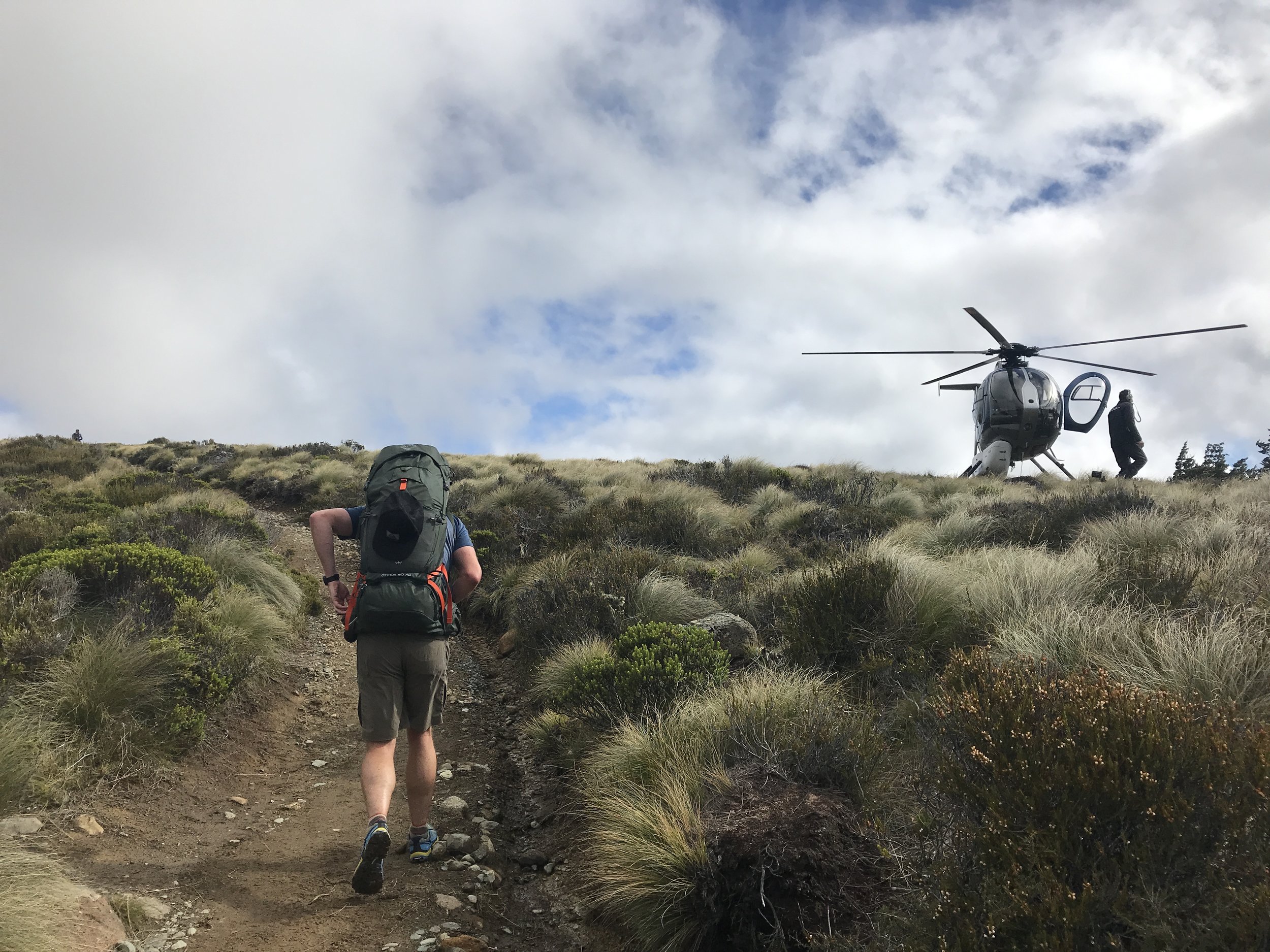
The incredible amount of work done to maintain the trail is evidenced by the quite heavy chopper traffic above us throughout the hike. Helicopters are the primary method of transportation and supply route in the Southern Alps of New Zealand and we see at least hour during our longest day and the following morning. All of the time, they have a net of cargo swinging underneath and they land at the helicopter pads to the side of the huts.
Passing by a chopper that has just landed to drop something off and pick something up
Chopper landing at the Luxmore Hut
We take a small detour to climb Luxmore Peak but a small cloud rolls in just in time for us to reach the peak. There are a few trampers taking a rest at the peak. A group of them are older Russians - in a typical welcoming fashion the Russian guy is cutting up an apple and offering everyone around a piece. He also comments to his friend and their wives that they could have climbed much faster if there had been less "chit-chat". I smile - it's obvious he means the wives, but it's all said in good humor.
If the views are amazing on our way to Luxmore Hut, they become absolutely jaw-dropping when we reach the ridge of the Kepler range and start our several hour traverse on it. Everywhere you look, you’re surrounded by 360 degree view of mountains and lakes.
The last part of the day is a brutally steep descent that lands us to the Iris Burn hut and campsite in the late afternoon. Our arrival is greeted with a a big sign telling us to find camping spots under trees and not in the open meadow because the keas roam around in the evenings and mornings stealing whatever they can get their curious beaks on. Apparently, their preference is for rubber (such as flip-flops and rubber handles of poles), as well as for bright colors. As we’re one of the first to arrive, we quickly find a spot in the forrest, next to a couple of trees.
When the ranger checks our permits later that evening, he advises us to keep everything covered with our tent fly but says that Keas have been known to poke under the tent fly and look around for goodies. But he also reassures us: “you’re lucky some people are camping in the open meadow. The Keas will start with them”. He also gives us an impersonation of the screaming of a female and of a male Kiwi bird. He says it’s common for people in the tents to get scared as the nocturnal birds start making sounds which resemble someone screaming in the middle of the night. The Kiwis are also quite quick and apparently disappear by the time you unzip your tent to see what the racket outside is all about.
The Kea "sitting ducks" at Iris Burn :)
The Keas are supposed to arrive in the evening at dusk but we don’t see them until the following morning as we’re packing our tent and luggage. With our stuff on the ground, I look up and see the familiar shape of the Alpine parrot perched on the branch nearby. He is keeping his eye fixed on me as he nimbly bounces to the left. I quickly realize he’s strategically edging his way towards my trekking poles on the ground. That’s when I spring into action and start chasing him around the campground (see video).
The walkout from Iris Burn is through a luscious forrest that leads us to Lake Manapouri - the lake we crossed on a boat when we took a trip to Doubtful Sound.
Lake Manapouri on our last day of walking the Kepler Track
The last few miles along the river on the Kepler Track
That afternoon and the following day the weather goes rainy and cold again, so we use the opportunity to visit the Te Anau Glowworm caves. Glow worms are a phenomenon observed in a lot of caves in New Zealand and the cave we visited is a more commercial one. It’s part of a huge complex that stretches dozens of miles underground right next to Lake Te Anau. We take the Real Journeys boat across the lake, which is a fun trip in an of itself and then visit the caves for half an hour. I’m amazed to find out that there is a whole river with waterfalls in the cave and as we ascend upstream, we come to an underground lake. Our guide points us to a little boat with wooden seats and once our small group is loaded on the boat, he turns his light off and proceeds to silently move our boat around the cave using ropes attached to the cave’s side. We keep complete silence and in the pitch dark, we can see the tiny little blue/white dots luminescing on the ceiling and the walls of the cave. It feels as if we’re swimming in the dark sky among the clouds.
Our trip to Fiordland is now complete for the time being and after the cave visit, we make our way back to Queenstown.


